(By Khalid Masood)
Introduction: When the Sky Turns Against You
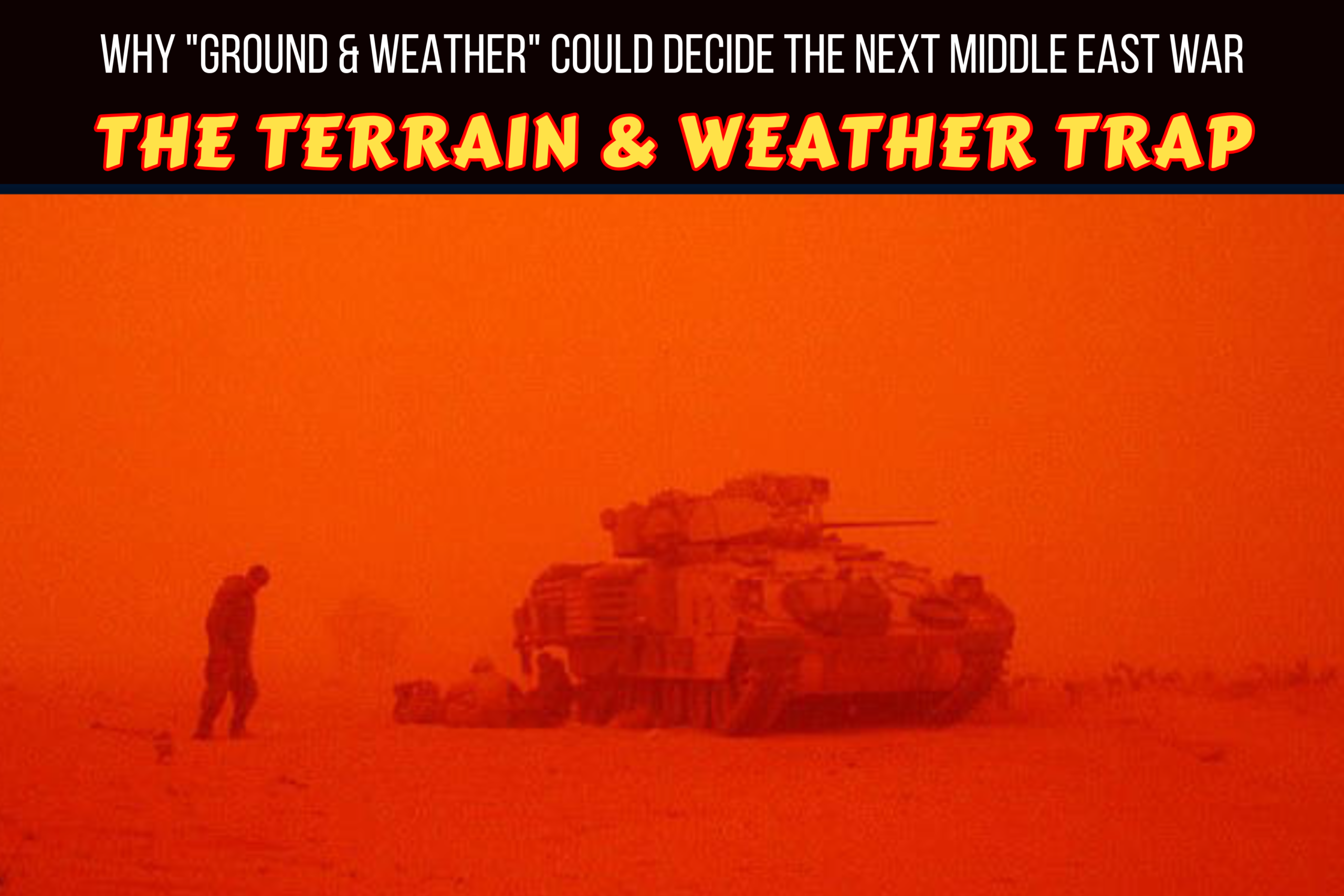
On March 25, 2003, a wall of sand—brown, choking, and absolute—slammed into the U.S. Army’s 3rd Infantry Division as it advanced toward Baghdad. Visibility dropped to less than 50 meters. Fine grit infiltrated rifle mechanisms, clogged tank treads, and jammed the switches on communication gear. Rain mixed with dust to create a slick, unstable mud that slowed convoys to a crawl. For nearly 24 hours, one of the most technologically advanced military forces in history was brought to a standstill—not by enemy fire, but by the environment itself.
That sandstorm is now a case study in military academies worldwide. It is a stark reminder that no amount of satellite imagery, precision guidance, or artificial intelligence can fully neutralize the oldest variables in warfare: ground and weather.
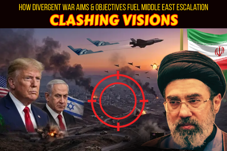
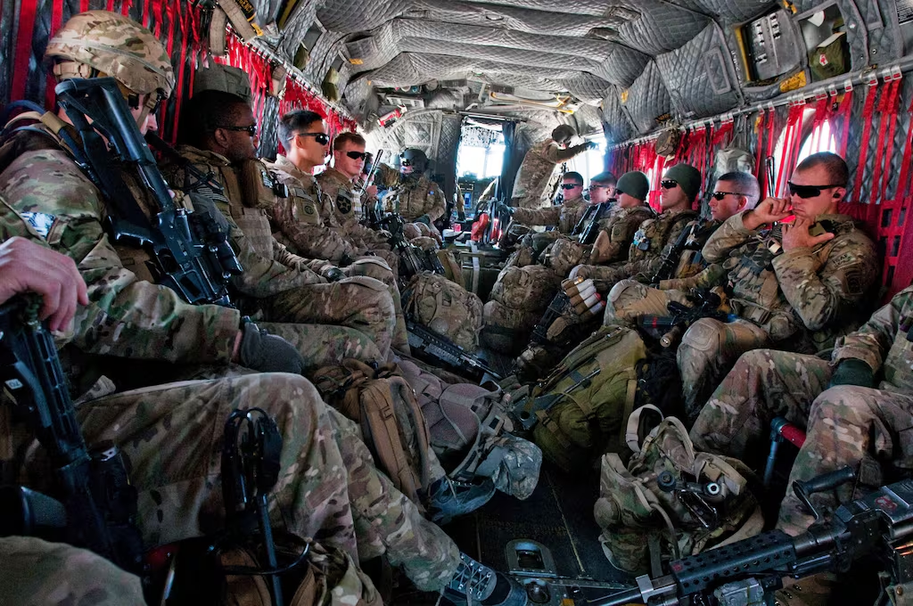
Today, as the United States prepares to deploy at least 10,000 additional soldiers to the Middle East amid escalating tensions with Iran, that lesson deserves renewed attention. Public debate focuses on troop numbers, missile counts, and political rhetoric. But behind closed doors, military planners are studying something far more fundamental: the physical reality of the battlefield.
Before a single order is issued, every professional military appreciation includes a dedicated section—often titled “Ground and Weather“—where terrain, climate, seasonality, and environmental risk are dissected in exhaustive detail. These factors do not merely influence tactics; they shape strategy, determine feasibility, and can ultimately decide victory or defeat.
This article examines why “Ground and Weather” is the silent arbiter of modern conflict—and why ignoring it could turn a calculated campaign into a costly miscalculation in the mountains, deserts, and coastal plains of Iran.
The Doctrine: Why Environmental Analysis Is Non-Negotiable
In military planning, intuition is a liability. Doctrine is the safeguard.
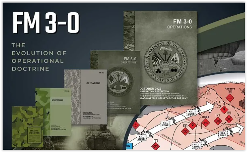
Across NATO and U.S. forces, the standard framework for operational assessment is known as METT-TC: Mission, Enemy, Terrain and Weather, Troops and Support Available, Time Available, and Civil Considerations. Notice the placement: Terrain and Weather is not an afterthought. It is a core pillar, analyzed with the same rigor as enemy disposition or logistical capacity.
Terrain analysis examines:
- Observation and Fields of Fire: What can be seen, and from where? Where can weapons be effectively employed?
- Cover and Concealment: Where can troops hide from observation or fire? Where can equipment be protected?
- Obstacles: Natural (rivers, mountains, marshes) and artificial (walls, minefields) barriers to movement.
- Key Terrain: Locations whose control offers a marked advantage—high ground, chokepoints, infrastructure hubs.
- Avenues of Approach: Routes that allow forces to move toward an objective with minimal exposure.
Weather analysis evaluates:
- Visibility: Fog, dust, precipitation, and light conditions affecting sensors and targeting.
- Precipitation: Rain, snow, or humidity impacting mobility, equipment function, and troop endurance.
- Temperature: Extreme heat or cold affecting human performance, fuel efficiency, and electronics.
- Wind: Direction and speed influencing drone operations, artillery trajectories, and chemical/biological dispersion.
- Seasonality: How conditions shift across months—critical for long-term campaign planning.
These factors are not abstract. They determine whether a paratrooper drop is feasible, whether armored columns can advance, whether air support can be reliably called, and whether supply lines can be sustained.
As the U.S. Army’s Field Manual 3-0 states: “Terrain affects the protection, concealment, and movement of forces. Weather affects the employment of weapons, the performance of equipment, and the physical condition of soldiers.”
In short: ignore ground and weather, and even the best-laid plan can collapse.
Case Study: The 2003 Iraq Sandstorm—A Lesson in Humility
The 2003 invasion of Iraq offers a textbook example of environmental disruption.
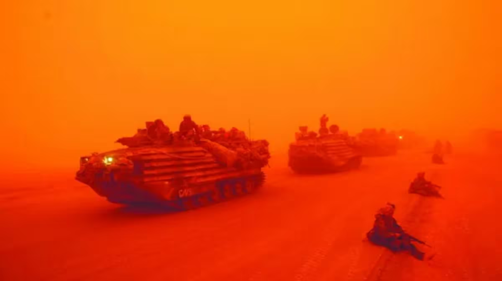
On March 25, just six days after the war began, a massive shamal—a seasonal northwesterly wind carrying dense dust—engulfed southern Iraq. For U.S. forces advancing along Highway 1 toward Baghdad, the effects were immediate and severe:
- Visibility: Reduced to 10–50 meters in some sectors, rendering visual navigation impossible.
- Equipment Failure: Sand infiltrated M1 Abrams tank filters, M2 Bradley fighting vehicle optics, and small arms mechanisms. Switchblades, radios, and even zippers jammed.
- Mobility: Muddy conditions from mixed rain and dust slowed convoys; some vehicles became stuck or required recovery.
- Air Support Degradation: Close air support missions were delayed or canceled due to poor visibility and targeting constraints.
- Communications: Static and interference disrupted radio networks, complicating command and control.
The U.S. response was adaptive: leveraging air superiority to strike immobilized Iraqi forces once the storm cleared, and using GPS-guided munitions that were less dependent on visual targeting. But the operational pause was real—and costly in terms of momentum.
The takeaway was not that technology failed. It was that technology has limits. Environmental factors can neutralize advantages, expose vulnerabilities, and force recalibration under pressure.
As one after-action report concluded: “The sandstorm reminded us that the battlefield is not a simulation. The earth and the sky do not follow our timelines.”
Applying the Lens to Iran: Terrain, Climate, and Operational Reality
If history is a guide, any potential ground operation against Iran would unfold in an environment far more complex—and less forgiving—than Iraq in 2003.
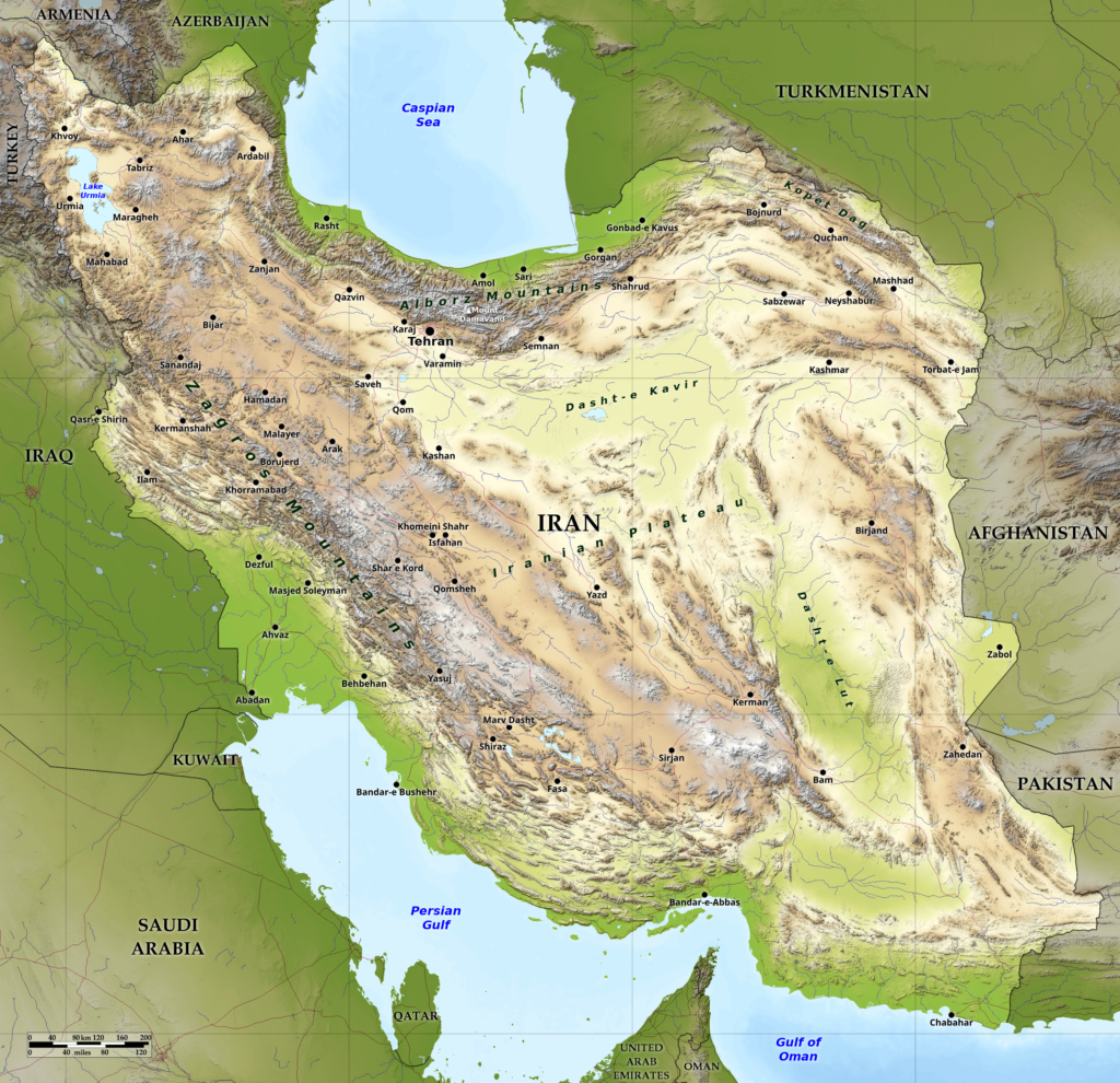
Iran’s Geographic Profile: A Defender’s Advantage
Iran is not a flat desert. It is a geographic fortress:
- Mountainous Borders: The Zagros Mountains run along the western frontier with Iraq; the Alborz range shields the north near the Caspian Sea. These ranges create natural chokepoints, favoring defenders who know the passes.
- Desert Interiors: The Dasht-e Kavir and Dasht-e Lut are among the world’s most inhospitable salt deserts—extreme heat by day, near-freezing by night, with minimal water sources.
- Urban Density: Tehran, Isfahan, and other major cities are densely populated, with complex infrastructure that complicates urban warfare and increases civilian risk.
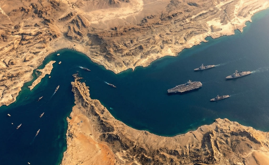
- Coastal Vulnerabilities: The Persian Gulf and Strait of Hormuz are narrow, shallow, and heavily mined—ideal for asymmetric naval warfare.
For an invading force, this terrain imposes severe constraints:
- Channeled Approaches: Armored columns would be funneled through mountain passes, making them vulnerable to ambush, IEDs, and anti-tank fire.
- Logistical Strain: Supply lines stretching across hundreds of miles of arid, contested terrain would require massive protection and sustainment efforts.
- Limited Concealment: In open desert, large formations are highly visible to satellite and drone surveillance—unless dust or weather intervenes.
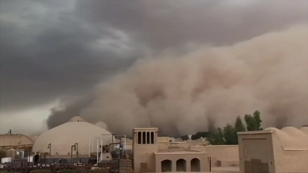
Iran’s Climate Calendar: Timing Is Everything
Weather in Iran is not a background condition; it is a strategic variable.
| Season | Key Conditions | Operational Implications |
|---|---|---|
| Spring (Mar–May) | Moderate temps; increasing dust activity | Optimal window for operations—but dust storms begin to peak |
| Summer (Jun–Aug) | Extreme heat (40–50°C/104–122°F); peak dust season | Equipment overheating; troop fatigue; reduced visibility; degraded sensor performance |
| Autumn (Sep–Nov) | Cooling temps; reduced dust; occasional rain | Improved conditions for maneuver; mud may affect off-road mobility |
| Winter (Dec–Feb) | Snow in northern/western mountains; cold in interior | Mountain passes may close; cold-weather gear required; some air operations constrained |
A 2023 study in the journal Sustainability notes that dust storms in Iran peak between May and July, particularly along the western border with Iraq and the southern coast near the Persian Gulf. These events can last hours or days, reducing visibility to near-zero and coating equipment in abrasive particulate.
Implication: A ground operation launched in summer would face not only enemy resistance but also environmental attrition. Troops would require specialized gear, enhanced medical support, and contingency plans for weather-induced delays.
The Strait of Hormuz: A Maritime Terrain Challenge
Any conflict involving Iran inevitably touches the Strait of Hormuz—the narrow waterway through which roughly 20% of global oil shipments pass.
Here, “ground and weather” translates to hydrography and meteorology:
- Shallow Depths: Limit submarine operations and favor mine warfare.
- Narrow Chokepoints: Create natural ambush zones for fast attack craft and anti-ship missiles.
- High Temperatures and Humidity: Stress shipboard systems and crew endurance.
- Fog and Dust: Reduce visibility for naval gunnery and helicopter operations.
Iran has invested heavily in asymmetric naval capabilities—swarm boats, sea mines, coastal defense missiles—precisely to exploit these environmental constraints. For the U.S. Navy, operating in the Gulf is not just a tactical challenge; it is an environmental one.
The Proxy Dimension: Home-Field Advantage in Complex Terrain
Iran’s strategy does not rely solely on its own forces. Its network of proxies—Hezbollah in Lebanon, Houthis in Yemen, militias in Iraq and Syria—operates in terrain that is equally complex and equally unforgiving.
- Lebanon: Mountainous, densely populated, with narrow valleys that favor guerrilla tactics. Hezbollah has spent decades fortifying positions in this terrain.
- Yemen: Rugged highlands, wadis (dry riverbeds), and limited infrastructure. The Houthis have used this landscape to offset Saudi-led coalition advantages in air power and armor.
- Iraq/Syria: Urban rubble, desert expanses, and river systems that create fluid, unpredictable battlefields.
For these groups, environmental familiarity is a force multiplier. They know which wadis provide cover, which villages offer supply routes, and how seasonal weather affects movement. An external force, by contrast, must learn the terrain under fire—a significant disadvantage.
As one retired U.S. special operations officer noted in an off-the-record briefing: “You can drop a battalion anywhere with GPS. But knowing where to drop it—and how to fight once you land—that requires intelligence no satellite can fully provide.“
The Planning Gap: Are Current Strategies Accounting for Reality?
Given these environmental complexities, a critical question arises: Are U.S. and Israeli military plans adequately accounting for ground and weather factors in a potential Iran campaign?
Open-source evidence suggests a mixed picture.
Strengths:
- U.S. forces have extensive experience operating in desert and mountain environments (Iraq, Afghanistan).
- Advanced modeling tools can simulate dust dispersion, terrain mobility, and weather impacts on sensors.
- Pre-positioned equipment and regional bases reduce some logistical burdens.
Uncertainties:
- Scale: A campaign against Iran would be orders of magnitude larger and more complex than prior conflicts.
- Adversary Adaptation: Iran has studied U.S. tactics for two decades and has tailored its defenses accordingly—including hardening infrastructure against precision strikes and dispersing assets to complicate targeting.
- Environmental Intelligence Gaps: While satellite data is abundant, granular, real-time weather forecasting in contested airspace remains challenging. Local microclimates and sudden dust events can defy prediction.
Some analysts argue that the emphasis on air power and stand-off strikes reflects an implicit acknowledgment of ground/weather risks: avoid putting troops in harm’s way if the environment itself is a hazard.
But as the 2003 sandstorm demonstrated, air power is not immune to environmental disruption. Dust degrades laser guidance. Cloud cover limits reconnaissance. Heat reduces aircraft payload capacity.
The risk is not that planners are ignoring ground and weather. It is that the sheer complexity of Iran’s environment may outpace even the most sophisticated models—especially in a dynamic, high-intensity conflict where conditions change by the hour.
Historical Echoes: When Terrain Decided Campaigns
Iran is not the first theater where ground and weather have shaped destiny. History offers sobering parallels:
- Napoleon’s Invasion of Russia (1812): The French Grande Armée was halted not by Russian armies alone, but by the scorched earth, vast distances, and the brutal Russian winter. Supply lines collapsed; morale broke; retreat became rout.
- The Vietnam War: Dense jungle, monsoon rains, and limited visibility neutralized U.S. advantages in firepower and mobility. The environment favored guerrilla tactics and prolonged attrition.
- The Soviet-Afghan War (1979–1989): Mountainous terrain and harsh winters enabled Mujahideen fighters to offset Soviet technological superiority. Supply convoys were ambushed in narrow passes; helicopters struggled in thin, cold air.
In each case, the invading force underestimated the environment—or assumed technology could overcome it. In each case, the earth and the sky had the final word.
As the military historian John Keegan observed: “War is not a contest of wills alone. It is a dialogue with geography.“
Conclusion: Mastering the Three-Dimensional Battlefield
As the Middle East braces for its next phase of conflict, the public discourse will continue to focus on missiles, sanctions, and summitry. These matter. But they are only part of the equation.
The silent variable—ground and weather—remains the ultimate arbiter.
For the United States, the challenge is not just deploying 10,000 soldiers. It is ensuring those soldiers can move, fight, and survive in an environment designed to resist them. For Israel, it is not just striking targets from the air. It is understanding how terrain shapes proxy behavior and escalation dynamics. For Iran, it is leveraging geographic familiarity to offset conventional disadvantages.
Victory in modern war is not won by firepower alone. It is won by those who best understand the battlefield in three dimensions: the ground beneath their feet, the air above their heads, and the time that binds them both.
In an era of artificial intelligence and hypersonic weapons, it is tempting to believe that the oldest factors in war have been rendered obsolete. The mountains of the Zagros, the dust storms of the Persian Gulf, and the narrow passes of Lebanon suggest otherwise.
As planners in Washington, Jerusalem, and Tehran study their maps, they would do well to remember the lesson of that Iraqi sandstorm in 2003: the earth does not take sides. But it always has a say.